 Orick - (5.8 Miles; Loop) - Prairie Creek Trail to West Ridge Trail
Newton B. Drury Scenic HighwayOrick, California 95555
Humboldt County
Website
Phone: 707-488-2039
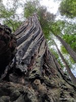
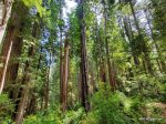
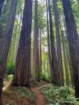
We were disappointed in the hike for about the half-mile after leaving the visitor center area as it was really crowded. After about a half-mile though, the crowds were left behind and it became an incredible hike through some amazing Coastal Redwoods.
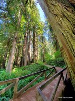
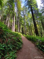
From the Visitor Center, you hike, more or less, along Newton B. Drury Parkway. You'll be able to hear the traffic and they'll be a decent crowd for the 2.6 mile path to Zig Zag 1. This part of the trail is really easy and also takes you by a trail which will allow to cut over to Big Tree if you'd like to check that out as well.
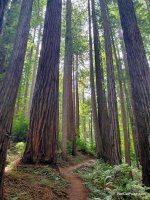
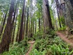
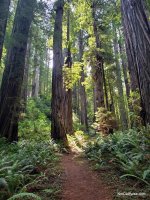
Once you make the roughly half mile route on Zig Zag 1 which takes you from the Prairie Creek Trail to the West Ridge Trail, the trail becomes more intense physically, puts you much deeper into groves of monster trees and is far more peaceful.
The West Ridge Trail is very manageable for most hikers but is certainly much more difficult.
If you're haven't done this loop and want to see what it's all about, it's a fun one. If you're looking to lose the crowds and want to get lost in the trees, skip the Prairie Creek Trail and consider just taking the West Side Trail out and back.
Park Info:
Prairie Creek Redwoods State Park is amazing! Check out our Prairie Creek Park Section for more info about all it has to offer.
Distance: 5.8 Miles Loop. We took Prairie Creek to Zig Zag 1 to the West Ridge Trail which led us back to the visitor center. There is a Zig Zag 2 that extends the hike just a little if you were looking for something longer.
Degree of Diffculty: This trail has two faces. The Prairie Creek section is easy going and kind of crowded. The West Ridge Trail is much more of what would be considered a redwood hike and far less crowded.
Dogs: No
Camping: Yes! Check out our Camping Section for camping at Prairie Creek Redwoods State Park.
More info:
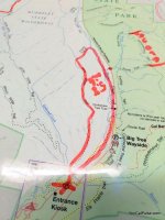
The map shows the location of the Visitor Center.
How to get there:
The Visitor Center, where the trailhead is located, is just off Highway 101, North of Orick. Check out the map for your best way to get there.
*Click on the photos to enlarge them.