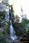
 Lassen Volcanic National Park - (3.8 Miles; O&B) - Mill Creek Falls
21820 Lassen Peak HighwayMineral, California 96063
Shasta County
Phone: 530-595-4480
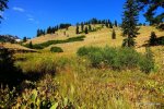
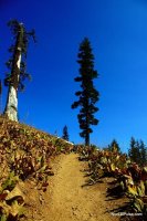
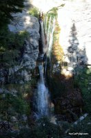
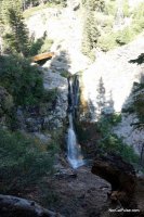
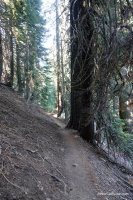
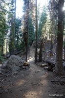
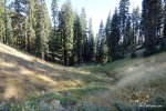
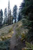
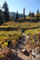
This well-maintained trail takes visitors through beautiful meadows and forested areas as it heads toward the highest waterfall in the park (75 feet). As you hike, you're likely to see wildlife as well; we've seen multiple deer each time we've visited.
The trail has a steady flow of small inclines and declines which makes it an easier hike than other hikes in the park of comparable distance. It's a fantastic hike anytime of the year but the wildflowers are at their peak during the late Spring and early Summer.
Overall, we really enjoy this trail and think you will too.
Distance: Just under 4 miles; round-trip.
Degree of Difficulty: Easy
Dogs: No
Camping: Yes. There is a small campground at the trailhead and a few others scattered around the park. You can get more info about camping at Lassen by clicking HERE.
More info:
The trailhead is in the parking lot of the south entrance, just to the right of the Kohm Yah-mah-nee Visitor Center. The park has a great deal on annual passes which is worth the money if you plan on visiting the park more than once during the year. Visit our section on Lassen Volcanic National Park for more things to do while you're there.
How to get there:
From Highway 36, just a few miles east of Mineral, turn north on to Highway 89 (Volcanic Legacy Scenic Byway) and you'll see the visitor center a few miles up the road. For other ways to get there, check out the map.
*Click on the photos to enlarge them